ETANA SYSTEMS launches SkyCompanion: All critical information for drone pilots in one app — now available in Germany
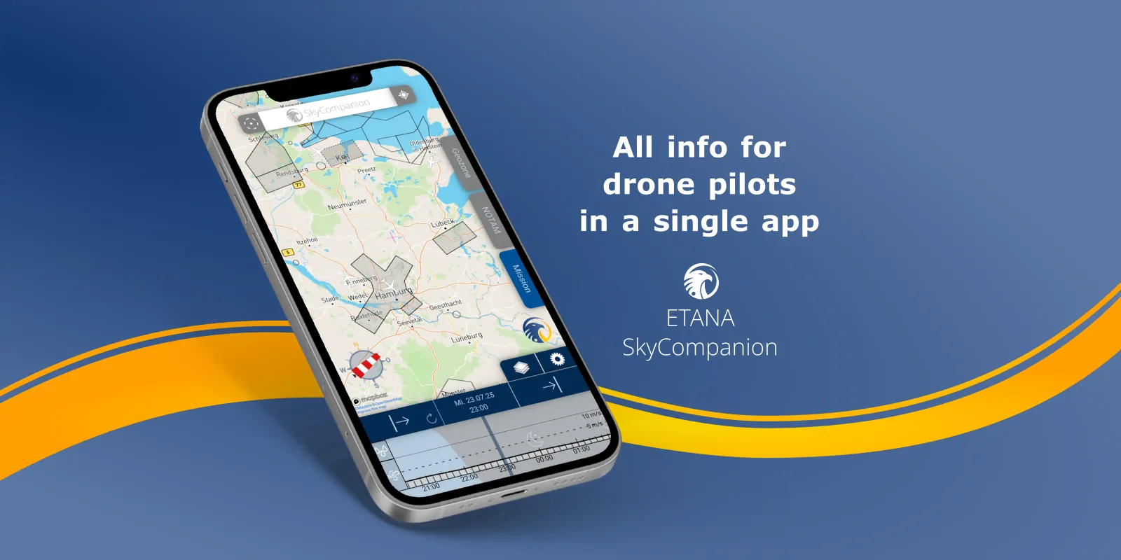
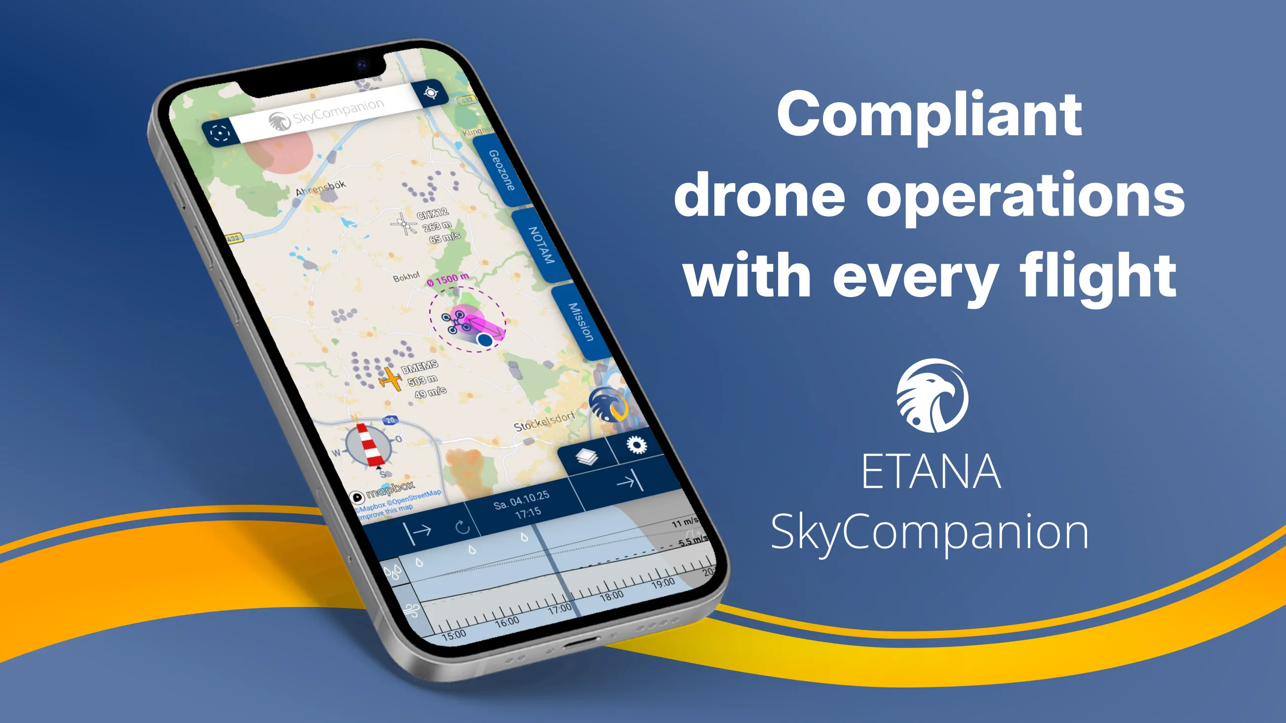
ETANA SYSTEMS has launched SkyCompanion, a mobile app that consolidates all critical information for drone pilots into a single operational picture: geo-zones, live air traffic, weather from DWD, and official NOTAMs. Professional pilots save time, reduce errors, and make clearer mission decisions without switching between multiple apps.
“We are drone pilots ourselves and repeatedly encountered inaccurate or missing data during missions. That is exactly why we developed SkyCompanion: one app with all the critical data so professionals can plan faster, decide precisely, and fly more safely,” said Martin Pietrek, Managing Director of ETANA SYSTEMS.
The app furthermore makes it easy to ensure legal drone flights. With integrated mission planning, assisted determination of the respective operations category, and automatically generated mission logs, every pilot can achieve fully compliant drone flights in no time. Valuable tips on regulations help with understanding the legal basics.
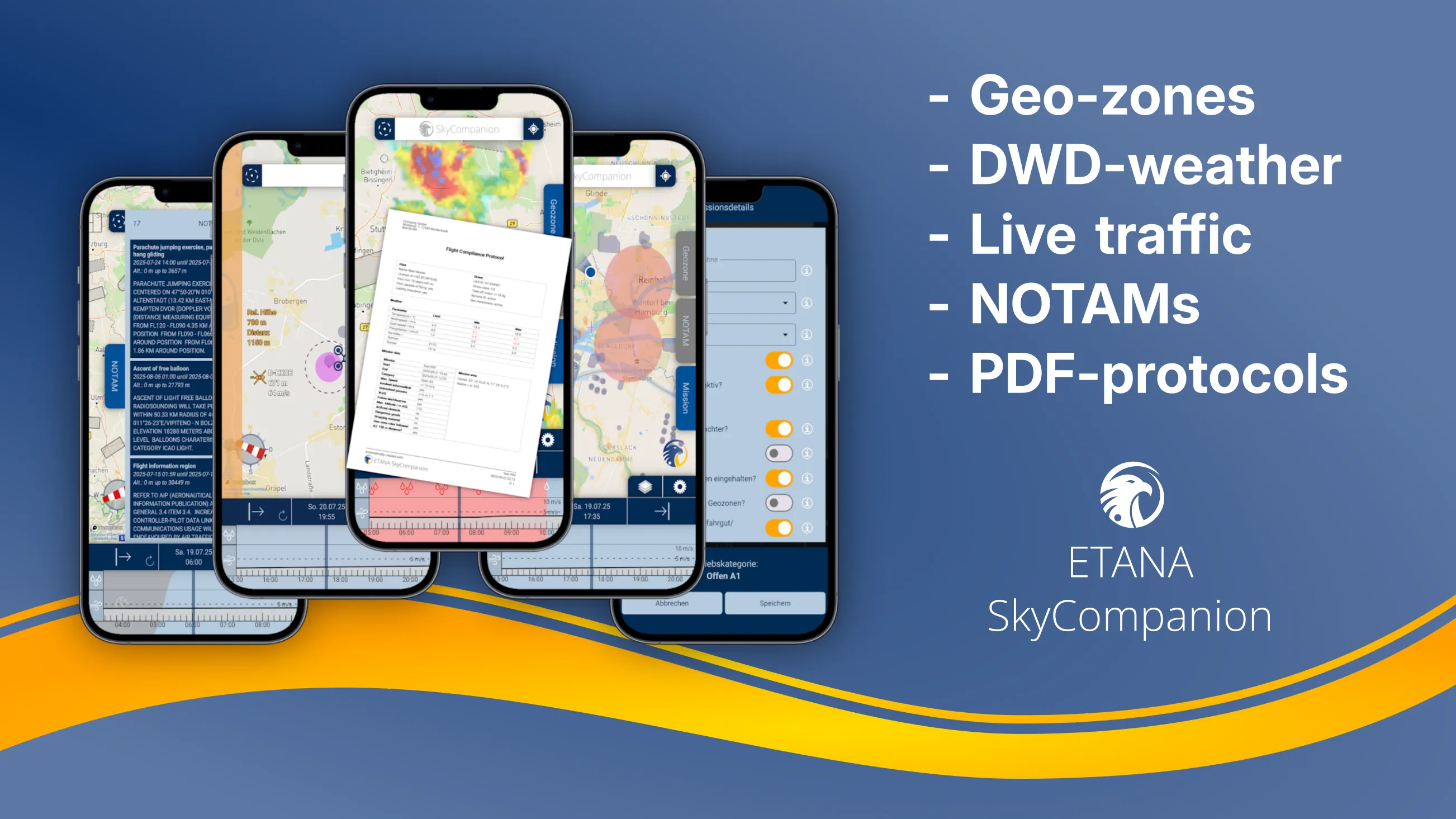
Geo-zones: In Germany, relevant information is spread across multiple administrative levels and authorities. SkyCompanion consolidates these data with the utmost care, keeps them continuously up to date, and presents them clearly. The result is one of the most comprehensive and current geo-zone databases for drone pilots in Germany.
Live air traffic: The data comes from ADSB Exchange, the world’s largest tracking network, capturing many aircraft that are otherwise difficult to track. Especially in lower airspace, where crewed and uncrewed aviation meet, this significantly increases situational awareness. A notification assistant signals when detected aircraft are on course for the mission area. Remote IDs of nearby drones are also shown, so uncrewed traffic is visible and incorporated into mission management.
Weather: SkyCompanion provides precipitation radar (including a 2-hour forecast) as well as forecasts for wind speed and direction, gusts, precipitation intensity, and the Kp index (including history and a 2-day outlook). The data comes from the German Weather Service (DWD), established in aviation and known for high quality.
NOTAMs: Through smart processing algorithms, SkyCompanion presents official NOTAMs in clear, readable language. This creates a complete picture of the current airspace situation in the mission area, understandable even for pilots with less NOTAM experience.
Mission reports: After the mission, SkyCompanion generates automatic mission reports as PDFs at the push of a button. This significantly reduces the effort required for documentation and compliance evidence.
SkyCompanion is available in Germany starting September 2, 2025, for iOS 16 or later and Android 9 or later.